When thinking of mass transport in Bristol, a few things might come to mind. Buses, Metrobus, and a proposed Underground System. A network of integration, it currently is not. Bristol’s bus system is largely seen by many as slow and inadequate as the transport spine for a city of its size. This is coupled with the fact that the idea of building an underground is politically sensitive and has a general perceptive of being a ‘pie in the sky’ idea. What if the city was reimagined?
To be clear, Enroute supports the existing Underground proposals within the city, but this could be a viable alternative for such a politically sensitive issue. (This proposal assumes that MetroWest Phase 1 & 2 is completed as a baseline).
This scheme has not been assessed for its technical feasibility and would be subject to a detailed review by specialist consultants.
Metro

Bristol is in dire need of an attractive backbone of a mass transport system. Here is an idea that Enroute proposes that takes inspiration from many cities across Europe:
- Manchester: Upgrading existing national rail lines/rail corridors into mass transport systems.
- Rotterdam: A system that can be an underground, tram and mainline train all on the same line. The Airport line would likely share tracks. The Green line would be built to a tram-train specification to allow cycle facilities to remain/ cut costs.
- Liverpool: A rail tunnel under the city centre.
- German/ S-bahn/Stadtbahn systems: City centre tunnel of interlined service to create a metro like system in the city centre with maximum coverage.
Upgrades would need to be made including the:
- Construction of new stations;
- Platform extensions to approx. 120m where necessary;
- Remodelling of Filton Junction and Narroways Hill Junction;
- Filton Bank slow lines (Narroways Hill Junction – Filton Junction) converted as well as all branch lines shown, additional tracks from Yate Junction – Filton Junction, Worle-Bristol Temple Meads, Keynsham – Bath Spa;
- Accessibility improvements;
- Signalling improvements to allow 4-6tph per branch and up to 24tph in the core;
- Full electrification;
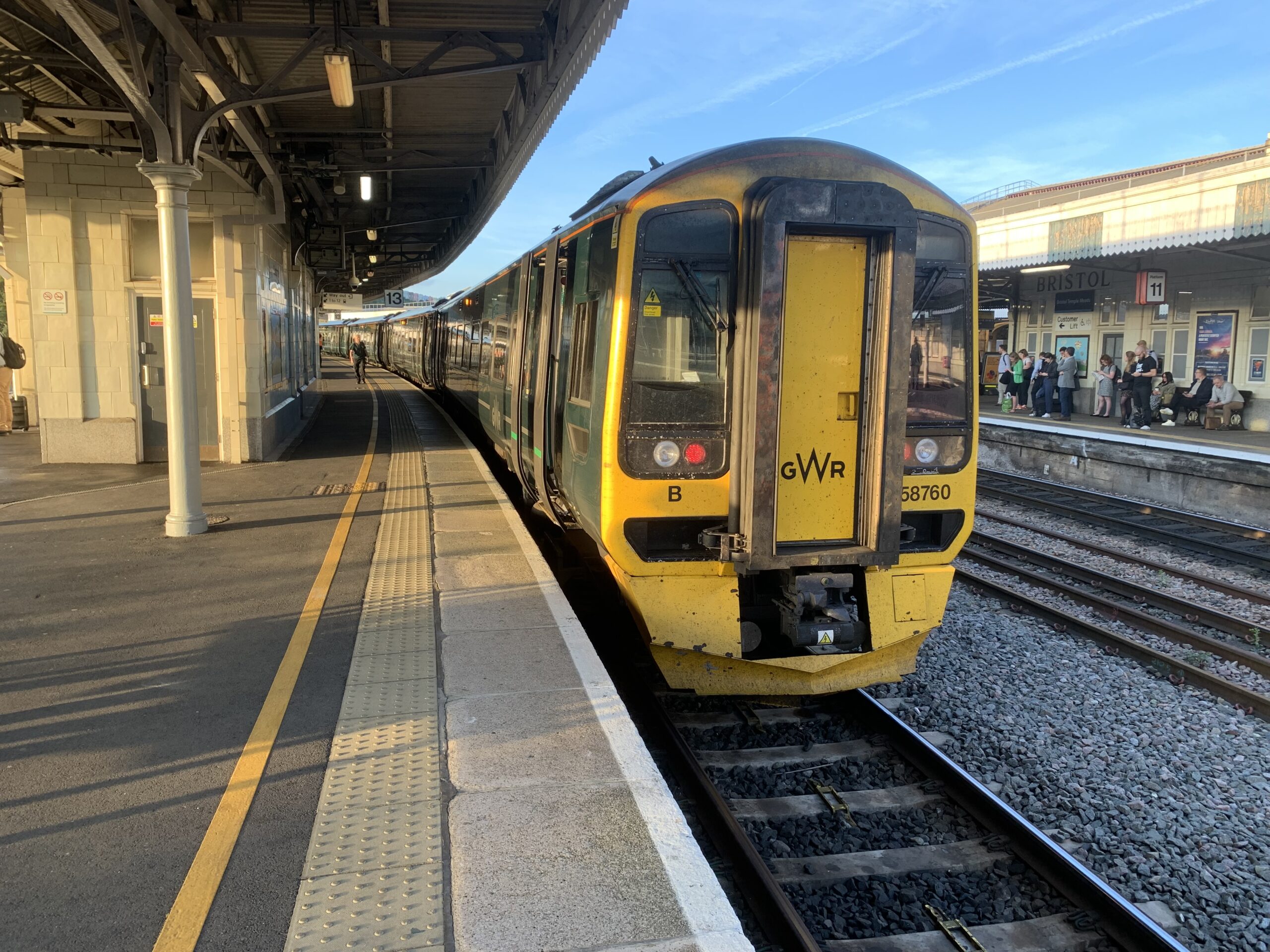
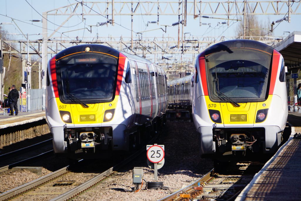
- A new fleet of trains with level boarding;
- A new Green Line. The Bristol to Bath cycle path would need to be considered, and compensatory mitigation measures such as a LTN 1/20 cycle route along Fishponds Road might need to be posed and constructed as an alternative for cyclists;
- New branches to Thornbury and Bristol Airport (shared with heavy rail);
- Mainline stations such as Nailsea & Backwell, Yatton, Weston Milton, Weston-super-Mare, Keynsham, Oldfield Park, Bedminster, Parson Street to lose connectivity beyond WECA area;
- Severn Beach Line enhancement. Double Tracking in its entirety and a new delta junction in Clifton;
- A new tunnel from the above proposed delta junction to south of Bristol Temple Meads; and
- A new/upgraded depot to store and maintain rolling stock.
These changes can all be considered as more minor, less disruptive, and likely cheaper than the current underground proposals and would likely help to create a ‘quieter’ public transport revolution within the city. An indicative alignment is shown below:
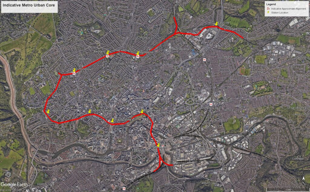
It is worth noting that stations within the Bristol area not on this map (e.g. Stapleton Road/Lawrence Hill/Patchway/a potential new St Anne’s station) will need to be served by existing regional services towards destinations including Cardiff, Gloucester, Taunton and Westbury to compensate for their reduction in service provision.
Within the city centre, the network has been designed to spread interchange throughout multiple stations, to reduce dwell times and spread crowds. The majority of rail interchanges would be at Temple Meads, and majority of bus/metrobus interchanges at St Augustine’s.
Metrobus

Bristol Metrobus currently acts as a service that largely fills up along the corridor and everyone travels into town. However, this enhanced network proposes a change to this strategy. The network is inspired by networks such as West Midlands Sprint and TFL Superloop to provide an integrated system with integrated fares (with the metro) to connect key nodes not feasibly on the metro network, and key suburbs.
This will create a drastic change as to how Metrobus is used, as it will mean buses will fill up and empty regularly at key nodes and stops shared with metro stations. That is the key of these 3 new extensions, to provide maximum interchange, and not necessarily minimum journey times into Bristol City Centre. This will help to create an attractive, polycentric, service that is a viable and convenient alternative to driving as well as a transport network that is less focused on Bristol City Centre.
Barring a few minor adjustments to largely avoid confusion (such as renaming stops in the city centre) the existing routes and proposed future/constructed extensions are shown. These are:
Route | Extension | Justification |
M2 (Orange) | Centre – Westbury on Trym | Connect key suburb of Filton, the major hospital (Southmead Hospital), Southmead and Westbury on Trym. This extension would mostly be useful for taking passengers to/from Filton Abbey Wood/Bristol Parkway. |
M3 (Light Green) | Emersons Green – Kingswood | To connect the transport desert of East Bristol (including Downend & Kingswood) to Staple Hill & Emersons Green metro stations |
M4 (Light Blue) | Centre – Kingswood | To connect the transport desert of East Bristol to Lawrence Hill station and Hick’s Gate metro station. |
All routes would be increased to a turn up and go frequency of at least every 10 minutes, and vehicles upgraded to something more suitable for buses that regularly empty and fill up along their route. This would be in the form of an articulated bus type vehicle (e.g. a Belfast Glider-style bus or a trackless tram).
Conclusion
Overall, Bristol as a major city in the UK requires major public transport investment. However, with the political situation, it could be a good idea to enhance what is already existing, rather than build new from scratch.
This network isn’t perfect, as there are still some connections that would be required to achieve a fully comprehensive network, such as an extension of M3 to Hanham, and a Metrobus link from Hengrove to Bedminster (which could be incorporated into an outer ring service from Long Ashton to Cribbs Causeway) to improve connectivity and fill in gaps. However, these services would not be considered initially, as it is important to design transport systems with realistic ambition that can grow over time as/when funding becomes available.
The B2B cycle path is the most used, most successful cycle path in the entire country – using it is a complete non-starter
It’s an idea – and it even states that a replacement route would be essential. Whilst I adore the b2b and used to use it daily, cycling is not for everyone. It was a rail line before so reverting it would seem to deliver on being a cheaper to implement proposal
If the metro solution took cars off the road in East Bristol as I think it absolutely would, there shouldn’t be any sacred cows – proper mass transit could make all the roads safer to be on and our air cleaner.
Look at Cardiff’s provision of segregated cycle routes that have taken up existing road. They are really good, safe and complement a city transport network well.
We need services back that can take buses between Fishponds and Yate. The Y5 which used to run via Staple Hill and Mangotsfield & the Y2 which used to run via Downend. Despite the Y2 service not being able to used original route, it could be re-diverted so it goes via the Westerleigh Road, like go as far as Trident on Badminton Road, turn right then all the way down to Westerleigh Road. We need them back.
I second Dan’s comment. The Bristol-Bath Railway Path is the jewel in the crown of Sustrans, its first route, created when the organisation was called Cyclebag. I can’t imagine a scenario in which Sustrans would let it go. Has Jacob walked or cycled the path? Although double track when it was a railway, the margins have succumbed to nature and it’s now quite narrow in places. There’s a corner in the Greenbank-Fishponds section that would require compulsory purchase of a residential property. The nimbys would be out in force. Various proposals have been made for converting the path back to rail. The best we can hope for is shared use, as exists with the Avon Valley Railway between Oldland Common, Bitton and Avon Riverside. The path would need to be widened in places and the corner property acquired, and the light rail formation single track with passing loops. If this can be achieved then the proposal has my support.
Double tracking the suburban railways: great! Going anywhere near the Bristol to Bath Railway Path? Don’t have think about it unless you want to be permanently banned from east Bristol. Look at the history of the last time the council tried to run buses down it with the same “we will have to do something for the cyclists nearby”. It is more than a cycle path: it is an extended urban park providing a pleasant and safe place to walk or cycle across the city and all the way to Bath. And it has walking and cycling traffic volumes way bigger than the woefully optimistic council projections -you’d be reducing traffic.
Please: step away from the keyboard and never make this suggestion again. I write as one of the founders of the previous campaign to save the railway path, who still has all the documents from that attempt on a hard disk, who still knows exactly who to kick start an new campaign to kill this one before it gets started. Focus on improving the railway lines rather than “unused” bits of railway you found on google maps.